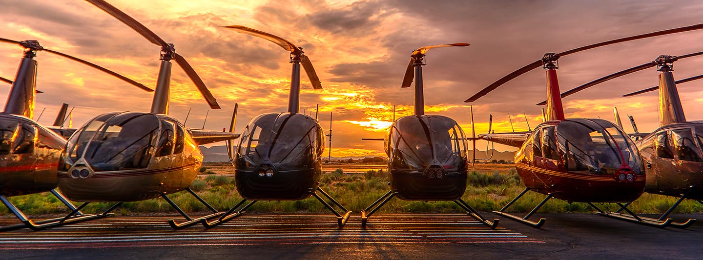
Comprehensive Aerial Surveying, Photography, and Videography
Your Aerial Vantage Point in Louisiana
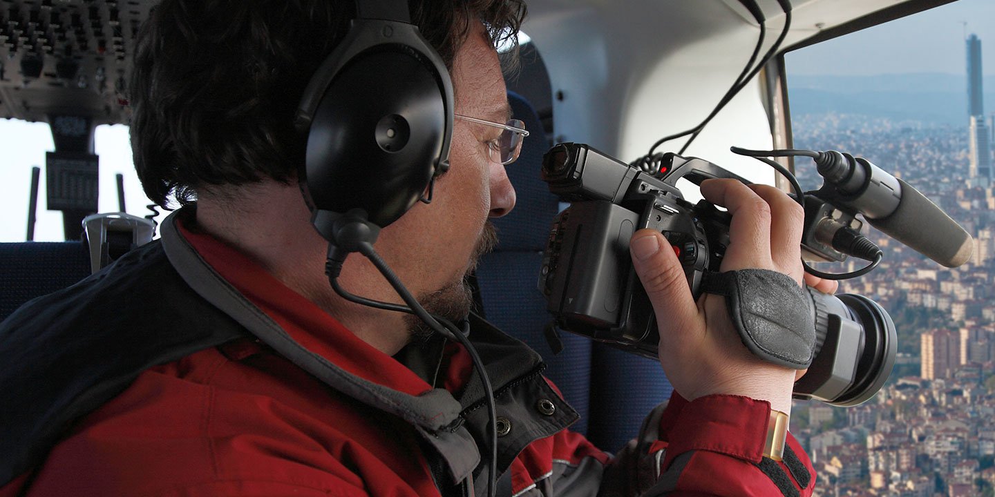
New Orleans Helicopter Charters delivers comprehensive aerial survey capabilities across Louisiana. Whether your project demands precise magnetometer and electromagnetic surveys, advanced LiDAR data acquisition, or detailed GIS mapping, helicopters offer unparalleled low-altitude flight and hover stability. We also provide specialized aerial filming services, leveraging cutting-edge cinematography and photography technology, including configurations for door-off operations to facilitate specialized handheld capture. For a complete overhead perspective and data collection across the diverse Louisiana landscape, our extensive options are engineered to meet your exact technical and creative specifications.
Aerial
Surveys
LiDAR, GIS Maps, FLIR, HD Video & More
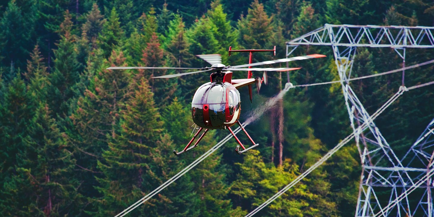
New Orleans Helicopter Charters provides essential aerial support for critical infrastructure. For pipeline surveys, Rights-of-Way (ROW) inspections, and transmission line patrols, we provision the optimal aircraft equipped with the necessary sensors and specialized equipment. This ensures precise data collection and efficient project completion, meeting rigorous industry standards across Louisiana.
High Tech Results
The Top Pilots in Louisiana, Today's Technology... Maximum Results.
Call 504-345-1818 Now!
New Orleans Helicopter Charters provides the tools needed to complete your land surveys, utilizing the right equipment to provide the aerial photos that are often needed.
Effective aerial surveys streamline critical operations such as Rights-of-Way (ROW) and site inspections, the acquisition of topographical data, and high-definition imagery for commercial projects. Helicopter-based surveys are superior for comprehensive oversight of Louisiana's diverse terrain, providing precise capabilities for pipeline leak detection, transmission line fault identification, and detailed property documentation. New Orleans Helicopter Charters specializes in developing bespoke photographic and remote sensing operations, meticulously customized to maximize technical efficiency, financial viability, and deliver superior actionable results for your specific project requirements.
For precise aerial surveying, helicopters offer distinct operational advantages over fixed-wing aircraft due to their unparalleled ability to maintain very low altitudes and slow airspeeds. While fixed-wing operations are typically restricted by FAA regulations to a minimum of 1,000 feet above the highest obstacle, helicopters can legally and safely conduct surveys at significantly lower elevations. This capability, coupled with their ability to hover, allows for meticulous inspection of critical infrastructure and hazardous zones, providing engineers with otherwise unattainable data and perspectives essential for accurate assessment and planning.
There is no better way to conduct your visual survey, animal population counts, soil drainage analysis, ROW inspections, pipeline and transmission line inspections, and geographical surveys.
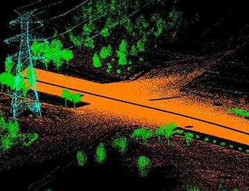
LiDAR Imaging
Light Detection and Ranging, or LiDAR, is a remote sensing method used to examine and measure Louisiana topography as well as objects, like vegetation, upon it.
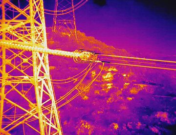
Infrared Imaging
Thermographic IR cameras are used to detect radiation in the long-infrared range of the electromagnetic spectrum and produce images of that radiation, called thermograms.
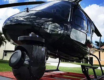
HD Video Gimbal Capture
Modern HD and 4K cameras can be mounted to helicopters, using the proper STCs, with a gimbal to stabilize photos & videos for detailed results.
Precision Aerial Filming and Professional Videography Services
For expert camera work in the New Orleans Sky
Get a Fast, free QuoteNew Orleans Aerial Cinematography
New Orleans Helicopter Charters provides unparalleled access to professional-grade aerial cinematography resources throughout Louisiana. We facilitate custom shoots utilizing advanced gyro-stabilized camera mounts, including industry-standard systems such as Tyler Mounts, Wescam, Cineflex, Pictorvision, and SpaceCam. These are integrated with leading specialty cameras like the Cineflex HD, RED Epic, Arri Alexa, and even cutting-edge 3D and experimental camera configurations. We deliver comprehensive support for all production goals, from dynamic air-to-air sequences to sophisticated ground-to-air shots. Collaborating closely with aerial Directors of Photography and directors, we ensure the precise capture of your artistic vision. Specializing in helicopter services for both still and motion photography, New Orleans Helicopter Charters can provision for nearly every media-related operation across Louisiana: feature films, television productions, documentaries, promotional videos, commercials, aerial props, critical relief work for broadcast networks, and extensive coverage of historical and major sporting events, deploying a diverse array of specialized helicopters for each mission.
Call Us Today at 504-345-1818 for a Free Quote
Contact Us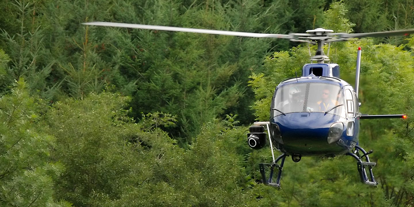
Aerial Photos
Hand-held or Mounted OpTions in New Orleans
We will help you get the right equipment for your aerial photography project! Call 504-345-1818 today to get a fast, free quote.
The Most Options for Photography
Louisiana's spectacular settings and breathtaking vistas are optimally captured from an aerial perspective. New Orleans Helicopter Charters provides specialized aerial photography charters, meticulously designed to translate your precise visual requirements into stunning imagery. We offer cost-effective photographic opportunities across the state, ensuring your vision is realized with unparalleled clarity. Many helicopters can be configured with door-off operations for specialized handheld photography projects, while for superior stability and cinematic precision, we recommend inquiring about our advanced gyro-stabilized camera mount solutions. This ensures every shot meets exacting professional standards.
Superior Service
Every one of our customers gets a dedicated helicopter expert to assist with flight plans, tech loadouts, production logistics, project schedules, and other demands.
Over 500 Aircraft
Our network of direct air partners extends well beyond New Orleans, Louisiana. This allows us to offer a wide range of solutions for even the most sophisticated projects.
The Best Equipment
From high-tech sensors like LiDAR, FLIR, and GIS to HD cameras and movie production gimbals, we're here to make your job as easy as possible.